

There is no doubt that times are a changing. Technology is rapidly invading every aspect of daily living. This shift begun to change the face of farming and ranching from manual field monitoring to what one high school student hopes will change once labor-intensive activities to a more cost effective and time efficient process.
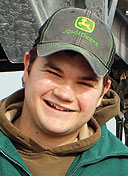
For Labette County high school student, Deven Foster, being in the right place at the right time means unlimited potential for advancing the cause of precision farming.
An active teen playing football, baseball and in FFA, Deven participates in the school’s vocational agriculture program, where he was introduced to Unmanned Aerial Vehicles or drones. The program utilizes a quadcopter for instructional purposes and, with the city of Altamont’s approval, inspection of the city’s water tower.
Deven is no stranger to farming or ranching, in fact, he and his brother Zach are fifth generation, with the original family farm still located near Ponca City, Okla. His father, Ken Foster, along with his brother, John and father, Jim, currently farm and run a cattle operation spanning 7,000 acres.
Becoming a business owner in high school is not the norm. Deven already was collecting soil samples as a subcontractor for AgChoice and spreading lime with his grandfather’s spreader truck for farmers in the area. Soon Lisa Blair with Southeast Kansas Education Center at Greenbush approached Deven. The center had an AgEagle fixed wing drone used primarily for demonstrations at schools but never in the capacity that it was designed for, crop monitoring.
With the new opportunity to practice actual crop monitoring with loan of Greenbush’s drone, Deven saw another door of opportunity open. Family support soon followed and Foster Ag Service and Technology, LLC was born. AgEagle, based in Neodesha, Kan., provided Deven with the training necessary to operate the $13,000 drone. This early version had its quirks, one of which required the operator to “stitch” the photos, taken in two-second increments, together to make a complete image. However, according to Tom Nichol, with AgEagle, the technology has already advanced to allow the software to stitch crop images seamlessly together at the completion of the flight. “I predict that as safe operations of small UAV’s, flown in agricultural survey settings…the (FAA) rules will be revised and not as restrictive,” Nichols states.
While UAV’s get some negative press, the benefits for agriculture and the environment are far outweigh what is discussed in the media. “The ease of use and the advancement of more reliable platforms and flight software will make the software more attractive each year,” Nichol said. The newest AgEagle UAV weighs less than 4 pounds and operates on electric rather than fuel and is capable of mapping 400 acres in 40 minutes. Drone imagery assists with variable rates when applying chemicals or fertilizers only where needed, “reducing costs, increasing yields and profits,” Nichols adds.
Drone technology’s potential to increase a farmers return on investment encourages developers to enhance ag technology to follow suit. One such farm tech tool is the ROI (Return On Investment) calculator software. In a Precision Ag article by Matthew Grassi, he highlights a study that states that drone use “enhances crop scouting, ROI is $12 per acre for corn, $2.60 per acre for soybeans and $2.30 per acre for wheat.”
Drone technology in the field not only saves wear and tear on farm equipment but precision farming techniques also have positive impacts on the environment. “If a farmer knows what spots of the field need more fertilizer, the mapping program helps them develop a variable rate application plan. Chemicals are less likely to leech out into creeks or nearby fields,” Ken states.


