COLUMBIA, Mo. – A new automatic weather station updates observations every five minutes on the Internet from Unionville.
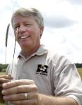
The station fills a gap along the Iowa line in the Missouri Mesonet, a network of 33 sites across the state, says Pat Guinan, University of Missouri Extension climatologist.
“We’re filling in coverage, especially along the state’s borders,” Guinan says. The network originated with MU Extension’s Commercial Agriculture Program. Current data aids farmers in planting, grazing, harvesting, grain storage and even controlled burns.
The new site falls between stations at MU Hundley-Whaley Center in Albany and MU Greenley Center in Novelty, east of Kirksville. Those research farms are part the Missouri Agricultural Experiment Station. Three new sites are being added this spring at public schools.
When selecting sites, Guinan worked with the weather service. “These fill gaps for them, as well. This can improve local forecasts,” he says.
Putnam County R-1 Schools, location of the newest station, will use weather data to teach science and vo-ag classes.
The state weather reports are used far beyond farms and schools, Guinan says. Insurance companies are frequent users. A new archive will be started with the Putnam County data. That will add to weather reports going back more than 100 years.
“We continue to monitor and document environmental changes,” Guinan says. “We’ve seen interesting climate trends in recent decades.”
One of the earliest stations started in 1994 at Sanborn Field on the MU campus in Columbia.
The Web page for the new site includes current conditions, plus maximums and minimums for today and yesterday. That includes temperature, precipitation and winds. Content includes dew point, humidity and barometric pressure.
The page links to the National Weather Service radar near Kansas City. A click shows radar sweeps from Kansas City.
The Unionville site is the northernmost station in the network.
For farmers the station updates soil temperatures under bare soil and sod at 2 and 4 inches. At Unionville, the sensors go down to 8 and 20 inches. “This will show the frost line,” Guinan says.
Water use by a crop can be indicated by estimated evapotranspiration per day. In wildfire season, firefighters can monitor fuel temperature and moisture.
In addition to delivery on computers, the data is available for mobile devices.
Other new stations are at Butler in Bates County, near Kansas, and Moscow Mills in Lincoln County, near Illinois.
A grant from the National Science Foundation funds the new sites at schools. It promotes science education and community outreach. For more, go to epscormissouri.org.
To see local weather from the Missouri Mesonet, go to agebb.missouri.edu/weather/stations.
Read more http://extension.missouri.edu/news/DisplayStory.aspx?N=2543


