COLUMBIA, Mo. – Remote sensors can play a big part of farming in the future. Those sensors can be on a 10-foot pole or a satellite 250 miles out in space.
The sensors of most interest at an agriculture technology fair, July 17, were on an unmanned aerial vehicle, or drone, that looks like a toy helicopter. Farmers and agribusiness came to see, learn and do.
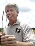
“Remote sensors offer amazing potential in data collection for farmers, people who advise farmers and scientists,” said Bill Wiebold, University of Missouri professor of plant science. “This is tomorrow’s agriculture.”
A technology-packed day at MU Bradford Research Center showed 100 participants current uses. Sensors were on highboys, four-wheelers and tractors.
It was pictures from drones that drew gee-whiz comments.
“Everyone who sees a drone thinks of new uses,” Wiebold said. “As an agronomist, I thought about improved scouting of crops for weeds, insects or fertility.
“When I show these to beef farmers, they see ways to track their herds. When Bootheel farmers saw them, they thought of checking irrigation rigs.”
Checking with drones to see if water pipes are flowing would save lots of walking. Seeing when crops need water does have commercial value, Wiebold said, but farmers gain personal enjoyment from doing a good job.
Wiebold spent much of his talk on new limitations imposed by Federal Aviation Administration regulations.
FAA, charged with safety of airspaces, is rewriting rules for commercial use of drones. That includes use by farmers. However, the FAA set back release beyond dates imposed by Congress, Wiebold said.
“The latest rules are more restrictive, not less so,” Wiebold said. “Learn the rules and abide by them. We want to keep airspaces safe. Like the FAA, whose motto is ‘Safety is our passion,’ we are good stewards of airspace as we are of land and water.”
Recreational use by hobbyists is less restricted, he said.
“Slow clarification of rules for use on farms is frustrating, frankly.”
Wiebold says his membership in the Academy of Model Aeronautics has been educational. Membership also provides insurance protection.
“Prior to recent rule changes, farmers used model-aircraft drones on their own property as long as they did not invade privacy of others.”
Wiebold showed videos, made before the restrictions, of his long-term Bradford research plots. “I gained a new perspective on what no-till ground looks like,” he said.
Aerial observation could save lots of time for graduate students checking and recording their research projects, he added.
All of his pictures were taken under 400 feet in the air.
Wiebold advised learning to fly a drone using an inexpensive model. “It’s different to crash a $1,000 unit than a $9,000 sensor.”
Satellite infrared photos of soybean fields reveal more information than pictures by cameras limited to visible light.
An infrared picture of a field showed an unexplained dead spot, unseen from the ground. That was determined to be the site of a lightning strike.
Aerial images lead to “directed scouting.” Pictures pinpoint where to go for an up-close look. “Without photos, you would never see those areas.”
Wiebold said he has promoted intense scouting of corn and soybean fields for years. “When crop farmers see these videos, they become interested in scouting.” Aerial scouting seems easier than getting lost in a field of tall corn.
Those at extension meetings on drones get excited about what they learn, Wiebold said. “I’m accused of being a salesperson for drones. I have no financial interest.
“I’ve had listeners at meetings go online and buy a drone while I’m still talking about them. Remote sensors are useful and available. It’s a matter of what platform delivers them best.”
Read more http://extension.missouri.edu/news/DisplayStory.aspx?N=2275


